Promotion
Use code DAD23 for 20% off + Free shipping on $45+ Shop Now!
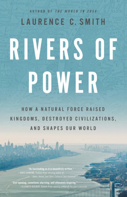
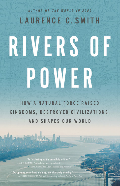
Rivers of Power
How a Natural Force Raised Kingdoms, Destroyed Civilizations, and Shapes Our World
Contributors
Formats and Prices
Price
$29.00Price
$37.00 CADFormat
Format:
- Hardcover $29.00 $37.00 CAD
- ebook $14.99 $19.99 CAD
- Trade Paperback $18.99 $23.99 CAD
This item is a preorder. Your payment method will be charged immediately, and the product is expected to ship on or around April 21, 2020. This date is subject to change due to shipping delays beyond our control.
Also available from:
Rivers, more than any road, technology, or political leader, have shaped the course of human civilization. They have opened frontiers, founded cities, settled borders, and fed billions. They promote life, forge peace, grant power, and can capriciously destroy everything in their path. Even today, rivers remain a powerful global force — one that is more critical than ever to our future.
In Rivers of Power, geographer Laurence C. Smith explores the timeless yet underappreciated relationship between rivers and civilization as we know it. Rivers are of course important in many practical ways (water supply, transportation, sanitation, etc). But the full breadth of their influence on the way we live is less obvious. Rivers define and transcend international borders, forcing cooperation between nations. Huge volumes of river water are used to produce energy, raw commodities, and food. Wars, politics, and demography are transformed by their devastating floods. The territorial claims of nations, their cultural and economic ties to each other, and the migrations and histories of their peoples trace back to rivers, river valleys, and the topographic divides they carve upon the world. And as climate change, technology, and cities transform our relationship with nature, new opportunities are arising to protect the waters that sustain us.
Beautifully told and expansive in scope, Rivers of Power reveals how and why rivers have so profoundly influenced our civilization and examines the importance this vast, arterial power holds for the future of humanity.
“As fascinating as it is beautifully written.”—Jared Diamond, Pulitzer Prize-winning author of Guns, Germs, and Steel, Collapse, and Upheaval
Excerpt
INTRODUCTION
When the first rains came, the world changed forever.
They would have come sooner, by 100 million years or so, if not for the collision with another planet. It was roughly the size of Mars. The crash was so massive that our young Earth was engulfed in fire and mostly melted. A giant piece sheared off and most likely became the Moon. A magma ocean churned and raged on the surface of the wrecked planet.
Then, the primordial surface began to cool. A crust of iron-rich rocks hardened on the Earth’s magma ocean. A lighter crust formed too, floating like slag in a smelter. A smattering of zircons, best known today for their use as inexpensive gemstones, began to crystallize. Trace remnants of them can still be found today in ancient rocks of Australia, Canada, and Greenland.
Australia’s zircons have been dated as far back as 4.4 billion years. This signifies that continental crust began forming on Earth much earlier than previously thought, perhaps just 200 million years after our planet first congealed out of a swirling disk of cosmic dust and gas some 4.6 billion years ago. The chemical composition of these crystals tells us that at least trace amounts of liquid water were already present, despite Earth’s extreme volcanism and the inferno caused by its collision with the other young planet. Like miniature time machines, zircons offer a glimpse into the Earth’s earliest eons, the Hadean (named after Hades, the Greek god of the underworld) and the Archean (derived from the Greek word arkhē , meaning “beginning”). From their chemistry, we’ve learned that our world’s early magma ocean cooled quickly and that continents and water came soon after.
By four billion years ago, if not sooner, rain began falling from the young sky. Water pooled in lakes and seeped into the ground. Water flowed overland into rivulets, streams, and rivers to the newly filling seas. Water evaporated into the poisonous air, condensed into clouds, and rained down again to complete the cycle. Water began eroding Earth’s infantile, thickening continental crust, opening an eternal war against the continents.
Bit by bit, the rains broke down the high ground and filled in the low. They dissolved rock and loosened minerals. They weathered mountains and nudged their detritus downhill. Trickles found one another, came together, and grew stronger. They joined together, over and over, until millions combined into a powerful force—rivers.
The rivers had one job to do: Move it all downhill. Down, down to the sea.
Where tectonic collisions raised mountains, water and gravity allied to grind them down. Where plates wrenched open new seas, rivers toiled to fill them. Muddied with silt, their waters coalesced like roots toward a stem. Gravel jostled and rolled down flowing branches to some final destination.
At the end of their run, the rivers died in seas and lakes. Spent, they dumped their sediments and evaporated like spirits, rising aloft, back to the high ground to attack, flatten, carry, and dump again. Mountains are tough, but even the mightiest spire is doomed to fall to this tireless enemy. The water cycle outlasts them all.
By at least 3.7 billion years ago, rivers were steadily depositing sediments into the world’s oceans. A couple hundred million years later, blue-green cyanobacteria—the world’s earliest photosynthesizers—began generating whiffs of oxygenated air. Around 2.1 billion years ago this oxygen production surged. Pyrite (fool’s gold) and other readily oxidized minerals disappeared from the riverbeds. The world’s iron-rich soils reddened like rust.
Another billion-plus years passed. Then, between 800 and 550 million years ago, the ocean’s exhalation of oxygen surged again. Sponges, flatworms, and other strange new marine life-forms appeared. In the eons to follow, these early organisms would persevere, advance, and eventually populate our world in strange and marvelous ways.
Meanwhile, the continents thickened and crashed about. New mountain ranges swelled and were beaten down. But their rocky substance was transmuted, not lost. The relentless rivers spread their debris across the lowlands, building wide, flat valley plains. Deep stratigraphic sequences were laid down, layer upon layer, slowly infilling the basins and seas. River deltas pushed out fingers of new land far offshore into the oceans.
Rivers are literally universal. From orbiting spacecraft, we see them on other worlds. Mars once had abundant liquid water, and its surface is now scarred with the dry channels, deltas, and layered sedimentary deposits of ancient rivers. At this very moment there are rivers flowing actively on Titan, a cold distant moon of Saturn. Their fluid is liquid methane and the bedrock they carve is believed to be made of ice, but the valleys, deltas, and seas they are busily creating are eerily Earthlike in pattern and form.
Oceans opened and closed. Continents crashed and bulged. Some of the rivers’ sediments were dragged deep down into the Earth’s mantle on the backs of subsiding tectonic plates, where they were ferociously squeezed and heated. The cooked remains further thickened the continents and rose, like heated wax in a lava lamp, to cool into the hardened roots of new mountain ranges. Eventually some of this same material was exhumed, pulverized, and carried off by rivers once again, for yet another journey back to the sea.
Our world’s destructive construction project never ends. Mountain ranges rise, then are pounded into sand. Their debris fans out across river valleys, deltas, and offshore continental shelves. Every earthquake, every landslide, every raging flood, marks just another little rumble in this ceaseless war between two ancient forces—plate tectonics and water—that are locked in combat for the shape of our world’s surface. Their war will continue for at least another 2.8 billion years or so, until our dying, expanding Sun boils away every last drop into steam.
Today, the rivers struggle to carry their loads to the sea. They slide past hardened cities, yoked by dams, throttled by engineers, overlooked by most. Still, the rivers prevail. They will outlast us all.
But we will not endure without them.
The many ways that humans use rivers have varied by region and changed over time. Yet their importance to us has persisted because they provide us five fundamental benefits: access, natural capital, territory, well-being, and a means of projecting power. The manifestations of these benefits have changed, but our underlying needs for them have not.
In Egypt, for example, the Nile River once supplied natural capital in the form of silt-rich floodwaters. Today, it supplies natural capital in the forms of hydroelectricity, municipal water supply, and high-value riverfront real estate in downtown Cairo. The Hudson River once supplied the Lenape with fish, then European immigrants a transportation gateway to the continent. Today this same river provides access to precious waterfront parks in New York City, a teeming metropolis with little greenspace. The details varied, but the five overarching benefits remained durable. Through these provisions, rivers have been serving human civilizations ever since our first great societies rose along the banks of the Tigris-Euphrates, Indus, Nile, and Yellow Rivers in present-day Iraq, India-Pakistan, Egypt, and China.
Throughout human history, our attraction to rivers has been on display through art, religion, culture, and literature. They meander through the paintings of Van Gogh and Renoir, the writings of Muir and Thoreau, the music of Johann Strauss II and Bruce Springsteen. Enduring works of fiction, from Twain’s Huckleberry Finn to Coppola’s Apocalypse Now rose from the dark waters of their imagining. People the world over are calmed by the sounds of rushing water from brooks, fountains, and sleep-therapy machines. To bathe in the Ganges River is a moving religious moment for millions of Hindus, as is the baptism rite for millions of evangelical Christians. Virtually all of our great cities—the world’s epicenters of knowledge, culture, and power—have a river running through their core.
This book contends that rivers hold a grandly underappreciated importance to human civilization as we know it. Rivers are of course important in many practical ways: they supply us with drinking water, coolant for power plants, and a means of removing sewage, for example. But they also shape us powerfully in less visible ways. Our repeated explorations and colonizations of the world’s continents were guided by rivers. Wars, politics, and social demographics have been jolted by their devastating floods. Rivers define and transcend international borders, forcing co-operations between nations. We need them to produce energy and food. The territorial claims of nations, their cultural and economic ties to each other, and the migrations and histories of people trace back to rivers, river valleys, and the topographic divides they carve upon the world.
Rivers are beautiful, but their hold over us is far more than aesthetic. Their allure stems from the intimate relationship we have shared with these natural landscape features since prehistoric times. Our reliance on them—for natural capital, access, territory, well-being, and power—has sustained us for millennia and grips us still.
CHAPTER 1
THE PALERMO STONE
Near busy downtown Cairo, at the end of a built-over island, stands a modest square structure. Atop its thick stone walls is a cone-shaped parapet. Surrounding the structure are a small palace, a museum celebrating the famed Arabic singer Om Kolthoum, and the Nile River.
If you enter the structure, you’ll discover it caps a stone-walled shaft, nearly forty feet square, sunk deep into the earth. Stone steps descend in flights around its walls. Rising up from the gloom, in the center of the space, is a massive marble column. Deep marks are cut into its octagonal sides at roughly equidistant intervals. Along the chamber’s lower walls three subterranean tunnels radiate away toward the Nile.
Inside this chamber, the din of the Middle East’s most crowded city is hushed. The entire shaft is invisibly encased in concrete, and the tunnels are sealed. But if they were reopened, the waters of the Nile River would rush in, flooding the chamber until its water level matched that of the river outside. The marks on the column could then be used to measure the height of the river. And for five thousand years this device, and dozens of others like it, served a critical purpose for the governance and survival of human civilization in Egypt.
The structures are called Nilometers (in Arabic, miqyas), and they were designed to empower Egypt’s rulers with constant updates on the progress of the annual flood of the Nile, one of the most predictable rivers in the world. Each summer, under rainless skies and baking heat, the Nile River would mysteriously swell over a period of weeks, crest its banks, gently flood the land, and then slowly recede. To an ancient people living in what is today called the Sahara Desert, this unfathomable, glorious annual event was miraculous and divine. They understood nothing of the physical reasons for the predictable arrival of the annual flood, but everything about its power.
The importance of the Nile River flood to the early Egyptians cannot be overstated. By enabling them to raise food and livestock in the desert, the flood enabled their civilization to exist. It will therefore not surprise you that accurate knowledge of the exact day and water level of its crest was of paramount importance to Egyptian rulers. Under their watchful eyes, the river’s water level would crawl up the Nilometer, halt, and then start a gradual descent, thus marking the passage of that year’s maximum water supply (see color plate). Pronouncements would be uttered, criers would shout, and slaves would rush to breach temporary earthen dams, allowing the Nile’s water to spill into the parched fields. Under the glaring sun, it spread out across the valley, inundating it for a few weeks before receding. Farmers followed close behind, pushing seeds into the rich mud. Like a dark sash cutting through the desert, the low-lying areas along the Nile River valley and its lobe-shaped delta jutting into the Mediterranean Sea turned green. The crops were irrigated and another year of survival was assured.
Even before the season’s first seed was planted, Egypt’s rulers already knew how big the harvest would be. They knew whether the following year would bring festivals or famine. The height of the flood peak, marked by the Nilometers, correlated directly with how much acreage of surrounding land would be inundated and planted. They already knew how much grain the farmers would produce—and they proclaimed the year’s taxes accordingly.
The Nilometer on Roda Island, in present-day Cairo, was founded in 861 CE, making it one of the youngest in Egypt. Earlier Nilometers were built along ancient, now-vanished river channels for thousands of years. At least four types have been discovered: a simple stone column, a wall or corridor of steps descending down into the water, a circular walled well (often ringed by steps descending down its sides) with openings to the river, and a combined well and column like the one in Cairo. The cut markings measured units of length called cubits, roughly as long a man’s forearm. In what may be the first direct linking of a quantitative scientific measurement to public health, Pliny the Elder used data from a Nilometer in Memphis, a now-ruined city on the Nile River delta, to predict the food security of ordinary Egyptians. Twelve cubits, he wrote, spelled death from famine. Thirteen, hunger. Fourteen, gladness. Fifteen, all was good. Sixteen, unbounded joy!
For thousands of years, Egyptians (and later, their invaders) used Nilometers to track the progress of the annual Nile River flood. So critical were these measurements that the annual water levels were etched, together with other important records like agricultural yields and tax revenues, onto an important stone slab (a stele) known as the Royal Annals. Seven fragments of the Royal Annals are held today by museums in Cairo, London, and Palermo. Their significance went unrealized for decades because they were untranslated and mostly bought from random antiquities dealers. One chunk is said to have been discovered while in use as a doorsill. The largest and best-preserved piece lay ignored until 1895, when a French visitor to Palermo noticed it languishing outdoors in the corner of a museum courtyard.
That fragment is now known as the Palermo Stone. Together with its six companions, it has shed more light on the history of ancient Egypt than any other archeological discovery. It was carved during the pharaonic Fifth Dynasty in the twenty-fifth century BCE, and includes a record of the Nile River’s peak flood level for every year as far back as the early First Dynasty, approximately 3100 BCE. The river’s flood history thus comprises humanity’s longest written scientific data record. Researchers have since used it to illuminate everything from natural climate variability to occasional outbreaks of social upheaval in ancient Egypt.
In the early 1970s, the Harvard University astronomer Barbara Bell was the first to link low Nile flood levels to the so-called First Dark Age of early Egypt, when the long-stable civilization fell into anarchy, bringing its Sixth Dynasty and Old Kingdom to a crashing end. Some of the grimmest decades in Egyptian history are associated with this period, with an overall breakdown of social order that included revolution, murder, looting, tomb robbing, and farmers too frightened to plant the fields.
Such episodes were rare. To help prevent them, Egypt’s rulers tightly restricted access to the information provided by their Nilometers. The structures were built inside or next to controlled temples, and only priests or other high-ranking officials were allowed to inspect them. The agricultural planning that was built around this system is one reason why the pharaonic empires survived for some three thousand years, suffering only three dark ages between the emergence of a unified Egyptian state (the First Dynasty, around 3100 BCE) and its conquest by Alexander the Great and subsequent absorption into the Roman Empire in 30 BCE.
It is unknown whether Egypt’s seductive and last independent ruler, Cleopatra VII, reflected upon the importance of the Nilometers as she lay dying from poison, but they were nonetheless a lasting part of the pharaohs’ legacy. Egypt became a vassal of the Roman Empire with the Nile River valley supplying about one third of Rome’s grain supply. Cairo’s Nilometer remained in operation until 1887, a thousand-year run. Flood-irrigation agriculture continued until 1970, when the construction of the Aswan High Dam ended the annual flood of the lower Nile valley. Egypt thus traded the Nile’s natural capital of flood irrigation for that of stable, controlled irrigation and hydropower generation.
For millennia, the benevolent annual flood of the Nile River sustained the Egyptian people and entrenched the power of its rulers. Without it, one of the world’s most stable and glorified civilizations would never have happened.
The Land Between the Rivers
Egypt’s pharaonic dynasties were unusually persistent, but they were hardly the first river societies. By 4000 BCE—more than a thousand years before the first Egyptian pyramid was built—an ancient civilization of Sumerians established some of the world’s oldest cities in lower Mesopotamia, the dry but fertile plains stretching between the Tigris and Euphrates Rivers south of Baghdad in modern-day Iraq. The origins of this civilization date back even further, perhaps as early as 7000 to 6000 BCE, when small-scale farmers began experimenting with stream irrigation in northern Iraq. The technologies they devised to divert water out of naturally flowing channels onto farmland would lead to humankind’s lasting invention, the city.
Mesopotamia, which means “Land between the Rivers,” was utterly different from Egypt. The Nile River flood spilled out gradually and gently upon the land and arrived in August, coinciding with peak agricultural water demand. The Tigris and Euphrates Rivers, in contrast, flooded from March to May, too early for optimal planting. To be useful for irrigation, the water had to be stored behind check dams, cajoled into smaller, more tenuous planting areas, or lifted up out of the main channels later in the year, when water levels were low. Their floods were violent, unpredictable, and damaging. The Nile flowed sedately through a single, stable channel, whereas the Euphrates River, in particular, split into madcap shifting branches, sometimes abruptly abandoning its channels to carve out a new path. Such sudden course shifts, called avulsions, instantly rendered useless years of backbreaking work spent building dikes and irrigation ditches.
Mesopotamian farmers had no choice but to follow the rivers’ gyrations around, digging new waterworks and cleaning out others choked with silt. Even without avulsions, the Land between the Rivers was prone to destructive floods that would periodically wipe out farmers’ efforts and bury their fields in useless sand. The chronic damage wreaked by floods, avulsions, and ordinary sedimentation led to a shifting patchwork of high-maintenance planting fields and irrigation infrastructure that was intermittently constructed and abandoned.
Despite these problems, irrigating the fertile plain was highly productive. Farmers grew more food than they could consume, creating surpluses that could then be traded. The population grew, and as early as 5200 BCE, fledgling towns with names like Eridu and Uruk began appearing along the shifting riverbanks. The economic and political forces that drove their experiences are still debated, but one thing is certain: Without the food surpluses reaped from irrigation agriculture, these settlements would never have developed.
As the young towns expanded, agricultural production intensified, the irrigation waterworks became more complex, and water planning became more centralized. Decision-making power shifted to urban priests and bureaucrats, and crops were taxed to support a ruling class. Other technological advances—like the ox-drawn scratch plow and the invention of long, narrow fields (which require fewer turns to plow than square fields)—further accelerated the production of wheat and barley. Uruk, Eridu, and other settlements along the Tigris-Euphrates waterways grew into regional centers of power and formidable city-states. Trade blossomed, and the river channels themselves became vital transportation routes for boats. By 4000 BCE urbanization had spread throughout southern Mesopotamia, with some eighty percent of all Sumerians living in cities. Uruk, with an estimated population of as many as 100,000 people, was the largest city that the world had ever seen.
Sometime after 2000 BCE, Uruk’s river channel shifted and abandoned the city. Devoid of water, its populace emptied out. Today, from satellite mapping, we can see how the locations of dozens of abandoned Sumerian cities and hundreds of archeological sites align with faint traces of ancient, long-dry river channels crisscrossing the Land between the Rivers. Uruk lies half-buried in blowing sand, its ghostly ruins marking the first of many empires—Akkadian, Babylonian, Assyrian, Ottoman, British, and Iraqi, to name a few—that would rise and fall over the following millennia in this deeply historic region.
Ark of the Tigris-Euphrates?
The twining Tigris-Euphrates river channels provided the food, water supply, and trade routes enabling Sumerian city-states to flourish. From these cities rose the beginnings of organized government, commerce, religion, and some of the world’s oldest known literary writings.
These writings include a remarkable series of twelve clay tablets, inscribed in crisp cuneiform lettering, dug from the ancient ruins of Nineveh near present-day Mosul, Iraq. One of them tells the story of an ancient visionary who received divine instruction to build a gigantic ship. It had to be built large enough to accommodate representatives of all living animals. Later, a black cloud rose from the horizon and a catastrophic flood inundated the world for six days and seven nights, destroying everything except the great ship. When the floodwaters subsided, the visionary and his passengers found themselves perched on a mountaintop, but they were otherwise unharmed and free to repopulate the world.
This flood story sounds like the biblical Genesis account of Noah and the Flood, but in fact predates the Old Testament by more than a millennium. It is written on one of the twelve tablets of the Epic of Gilgamesh, which describe a legendary king of Uruk. The earliest stories on these tablets, which themselves date to 1200 BCE, trace back to 2100 BCE, and they were likely adapted and rewritten from even older versions.
From other archeological evidence we know there really was an Uruk king named Gilgamesh who ruled sometime between 2800 and 2500 BCE. His city is mentioned in the Old Testament (called “Erech,” Genesis 10:10), and other similarities between the Epic of Gilgamesh and the biblical story of Noah and the Ark suggest that both documents share a common origin in ancient Iraq. Based on the age of the Sumerian tablets (and some even earlier writings from which they borrow) the origins of the Great Flood legend can be traced back for thousands of years, perhaps even into the Neolithic Period in Mesopotamia, around eight to twelve thousand years ago.
While there is absolutely zero geological evidence of a global flood during these (or any other) times, numerous credible studies suggest that a real-world local catastrophe may have inspired the legend. One popular hypothesis is that rising global sea levels forced a surge of seawater over the Bosporus outlet into the Black Sea. Another singles out the lowermost end of the ancient Tigris-Euphrates river valley, now part of the seafloor of the Persian Gulf.
At the height of the last ice age (called the Last Glacial Maximum, or LGM) around 21,000 years ago, global sea level averaged some 125 meters lower than today. The present-day Persian Gulf, extending from Dubai to Kuwait City, was a broad river valley dotted with freshwater lakes. What is now the Strait of Hormuz, one of the most strategic and militarized maritime corridors in the world, was a flat, wide, fertile river valley. Due to its gentle topographic slope, this ancient valley became inundated when global sea levels rose rapidly from approximately 10,000 to 4000 BCE, due to the melting of continental ice sheets and thermal expansion of ocean water as it warmed. The rising sea expanded more than a thousand kilometers inland, drowning the river valley and creating the present-day Persian Gulf. Because of the valley’s extremely flat topographic relief, the sea’s advance averaged more than 100 meters per year, and sometimes more than 1 kilometer per year.
To the region’s human inhabitants, living on what is now the muddy seabed of the Persian Gulf, the relentless inundation of their homeland over the course of many generations was surely a noticed and traumatic event. Oral (and eventually written) accounts of their forced migration may have passed down to their descendants and could be the original source of the Gilgamesh epic, the Old Testament account of Noah and the Ark, and other ancient Great Flood legends.
Secrets of the Sarasvati
The Egyptian and Sumerian civilizations are highly studied, but they pale in sheer scale to the Harappan civilization of South Asia. Between approximately 2500 and 1900 BCE this remarkably advanced culture flourished along the Indus and Ghaggar-Hakra River valleys and their tributaries across a large swath of modern-day Pakistan and northwestern India. One archeological study at Bhirrana, India, suggests that the Ghaggar-Hakra settlements may have been established even earlier, between 7000 and 5000 BCE. If true, this means the Harappan civilization emerged nearly two thousand years before the earliest Sumerian city-states.
Harappan villages, towns, and cities eventually spread across more than a million square kilometers, an area larger than the Egyptian and Mesopotamian civilizations combined, from the foothills of the Himalayas down to the coast of the Arabian Sea. Their inhabitants invented writing, granaries, brick-lined water wells, and urban planning. They built sophisticated municipal plumbing systems with running-water baths, toilets, aqueducts, and enclosed sewers—some two millennia before these same defining features of modernity appeared in ancient Rome.
Like the Egyptians and Sumerians, the Harappans were a river people. They planted and irrigated crops of wheat, barley, millet, and dates in the fertile floodplain silt deposits. Food surpluses supported urbanites living in well-planned cities built with burnt bricks. The best-studied are Mohenjo-daro and Harappa, two particularly large cities being excavated in modern-day Pakistan. In the mid-nineteenth century, their ruins were mined by colonial British railroad engineers, who used the ancient bricks for track ballast. The antiquity and importance of these ruins were not appreciated until 1924, when the first archeological studies began.
Genre:
- "What do rivers give us? Among many other things: cheap transport, dam disasters, fish, floods, highways, hydroelectric power, inspiration for art and music, irrigation water, national boundaries, and the reason for Stalingrad. This book about rivers is as fascinating as it is beautifully written."—Jared Diamond, Pulitzer Prize-winning author of Guns, Germs, and Steel, Collapse, and Upheaval
- "Laurence C. Smith takes readers on a tour of the world's great rivers -- past, present, and future. The result is fascinating, eye-opening, sometimes alarming, and ultimately inspiring."—Elizabeth Kolbert, Pulitzer Prize-winning author of The Sixth Extinction
- "Rivers of Power transforms something quite common and often unappreciated into a compelling subject of critical importance to humanity. With scholarship, literary flair, and a personal touch, Smith takes the reader on a fascinating and surprising voyage of discovery, illuminating the myriad ways in which rivers have molded the course of history. He also sounds a clarion call for all of us to invest in understanding, revitalizing, and protecting our rivers as a means of improving our own lives."—Eric Jay Dolin, bestselling author of Black Flags, Blue Waters
-
"In Rivers of Power, Laurence C. Smith brings gentle humor and a gift for storytelling to the task of explaining a force that has shaped the earth for over three billion years. The result is an eye-opening and occasionally chilling account of the past, present, and future of both rivers and the humans that depend on them. An important new read."
—David Frye, author of Walls: A History of Civilization in Blood and Brick -
"Smith has written a tour de force -- a narrative as powerful as the rivers he documents. He is up there with Jared Diamond -- a storyteller with real craft, and an academic career that makes him an important part of the modern revival of geography. Rivers determine where we live and often how we live, too. From Herodotus musing on the Nile to the dam makers of modern China, this is their story."
—Fred Pearce, author of When the Rivers Run Dry and The New Wild -
"Rivers of Power speaks compellingly to the intersection of geography and history and its significance for the development of the world as we know it."
—Professor Julian Dowdeswell, Director of the Scott Centre for Polar Research, University of Cambridge -
"A valuable, well-observed work of history and geography."
—Kirkus - "This engagingly panoramic and truly global discussion of the connection between rivers and human civilization serves as an important reminder of our dependence upon the planet's arteries of fresh water."—Booklist
- On Sale
- Apr 21, 2020
- Page Count
- 368 pages
- Publisher
- Little Brown Spark
- ISBN-13
- 9780316412001
Newsletter Signup
By clicking ‘Sign Up,’ I acknowledge that I have read and agree to Hachette Book Group’s Privacy Policy and Terms of Use