Promotion
Free shipping on $45+ Shop Now!
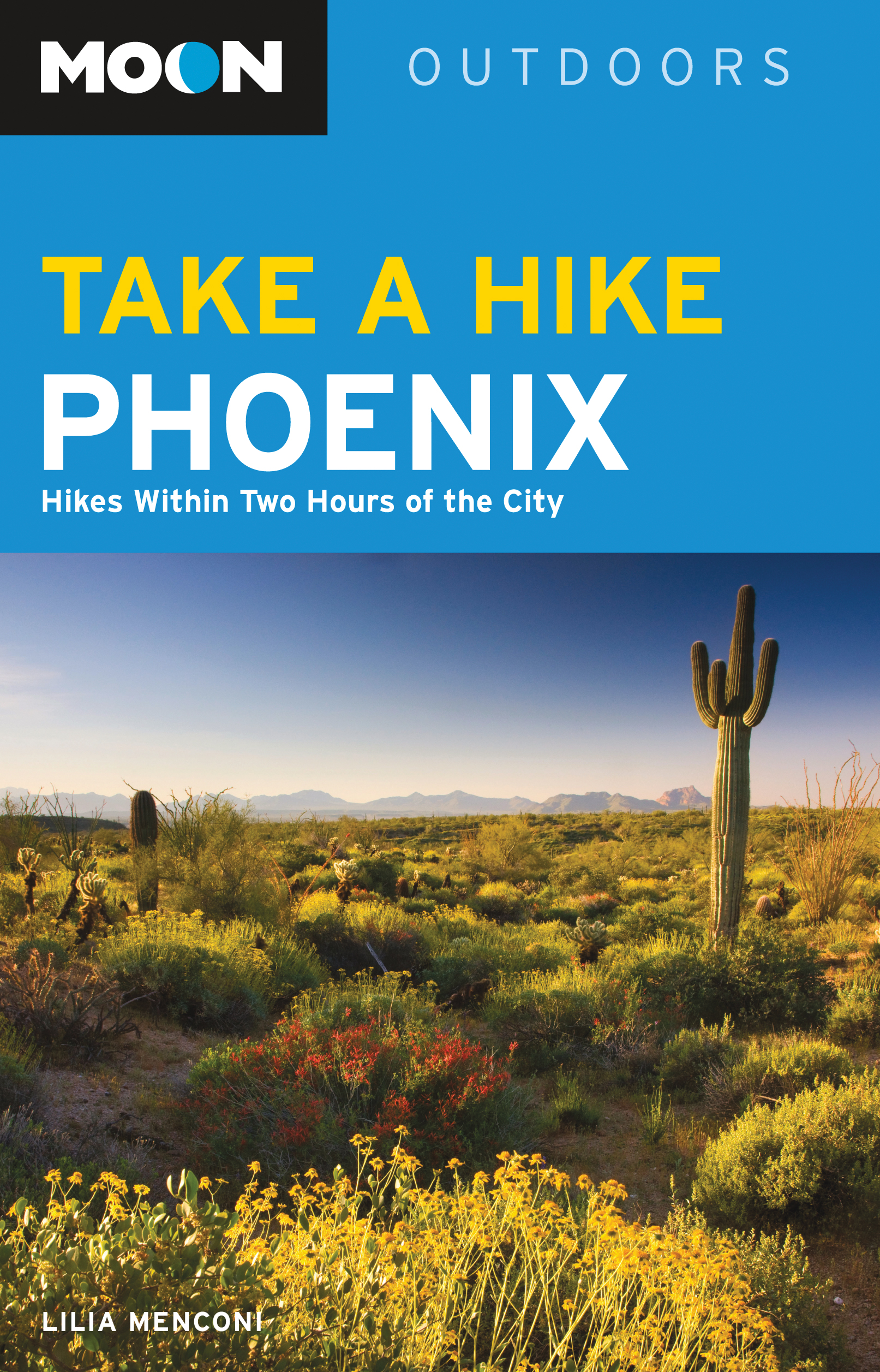
Moon Take a Hike Phoenix
Hikes Within Two Hours of the City
Contributors
Formats and Prices
Price
$9.99Price
$12.99 CADFormat
Format:
- ebook $9.99 $12.99 CAD
- Trade Paperback $19.99 $24.99 CAD
This item is a preorder. Your payment method will be charged immediately, and the product is expected to ship on or around June 16, 2015. This date is subject to change due to shipping delays beyond our control.
Also available from:
- Detailed Descriptions: Find the right hike for you with thoughtful and thorough descriptions of what to expect along each trail. Pick from a variety of hikes ranging from flat routes suitable for families to challenging rock scrambles. Escape the city for a few hours or take a day-long trek to ultimate solitude.
- Quick Reference: Compare difficulty ratings, distance, and elevation gain to pick which trail to tackle in an easy-to-scan chart. Icons identify hikes that are dog-friendly or wheelchair accessible-and highlights like historic sites, wildlife, and wildflowers
- Maps and Directions: Easy-to-use maps for each trail showing topography and elevation. Point-by-point navigation guides you along the right path and prepares you for changes in terrain. All hikes include GPS coordinates and detailed driving directions (including access via public transit when available) for each trailhead.
- Best-of Lists: Get ideas for where to start with hikes sorted by interest or difficulty, including “Best Near Water,” “Best Summit Views,” and “Best Kid-Friendly Hikes.”
- Trusted Advice: Born and raised in Phoenix, author Lilia Menconi shares the experience and knowledge she’s gained hiking in and around her hometown. Lilia also includes essential tips on desert safety and ways to beat the heat.
Looking to explore beyond Phoenix? Try Moon Southwest Road Trip. Ready for an overnight outdoor adventure? Check out Moon Grand Canyon.
Excerpt
How to Use This Book
ABOUT THE MAPS
This book is divided into chapters based on regions that are within close reach of the city; an overview map of these regions precedes the table of contents. Each chapter begins with a region map that shows the locations and numbers of the trails listed in that chapter.
Each trail profile is also accompanied by a detailed trail map that shows the hike route.
Map Symbols
ABOUT THE TRAIL PROFILES
Each profile includes a narrative description of the trail’s setting and terrain. This description also typically includes mile-by-mile hiking directions, as well as information about the trail’s highlights and unique attributes.
The trails marked by the B symbol are highlighted in the author’s Best Hikes list.
Options
If alternative routes are available, this section is used to provide information on side trips or note how to shorten or lengthen the hike.
Directions
This section provides detailed driving directions to the trailhead from the city center or from the intersection of major highways. When public transportation is available, instructions will be noted here.
Information and Contact
This section provides information on fees, facilities, and access restrictions for the trail. It also includes the name of the land management agency or organization that oversees the trail, as well as an address, phone number, and website if available.
ABOUT THE ICONS
The icons in this book are designed to provide at-a-glance information on special features for each trail.
The trail climbs to a high overlook with wide views. | |
The trail offers an opportunity for wildlife watching. | |
The trail offers an opportunity for bird-watching. | |
The trail features wildflower displays in spring. | |
The trail visits a beach. | |
The trail travels to a waterfall. | |
The trail visits a historic site. | |
The trail is open to snowshoers in winter. | |
Dogs are allowed. | |
The trail is appropriate for children. | |
The trail is wheelchair accessible. | |
The trailhead can be accessed via public transportation. |
ABOUT THE DIFFICULTY RATING
Each profile includes a difficulty rating. Definitions for ratings follow. Remember that the difficulty level for any trail can change due to weather or trail conditions, so always phone ahead to check the current state of any trail.
Easy: Easy hikes are 4 miles or less and with an elevation gain or loss of 500 feet.
Easy/Moderate: Easy/Moderate hikes are 4–6 miles long and with an elevation gain or loss of 500–1,000 feet.
Moderate: Moderate hikes are 2–8 miles long and with an elevation gain or loss of 1,000–1,500 feet.
Strenuous: Strenuous hikes are 6–10 miles long and with an elevation gain or loss of 1,000–2,000 feet.
Butt-kicker: Butt-kicker hikes are 8–14 miles long with an elevation gain or loss of 2,000 feet or more.
INTRODUCTION
Author’s Note
Best Hikes
B Butt-Kickers
B Climbing and Scrambling
B Hikes near Water
B Historical Hikes
B Kid-Friendly Hikes
B Solitude
B Summit Views
B Wildflowers
B Wheelchair-Accessible Trails
Hiking Tips
Hiking Essentials
Water
Sun Protection
Clothing
Navigational Tools
Food
Light Source
First-Aid Kit
Health and Safety
Fitness
Hiking Solo
Heat Exhaustion and Heat Stroke
Hypothermia
Flash Floods
Dust Storms
WILDLIFE AND PLANTS
Coyotes
Snakes and Lizards
Scorpions and Insects
Cacti, Succulents, and Wildflowers
ON THE TRAIL
Trail Etiquette
Hiking with Children
Hiking with Dogs
Adopt Trash
Author’s Note
Want to know about Phoenix hiking? Ask a native. Only, that might be easier said than done. Phoenix is a city of transplants.
Fortunately, with Moon Outdoors Take a Hike Phoenix, you can experience the best hikes in the Phoenix area, each recommended by me—a gal who was born and raised in Phoenix. Whether you’re a newcomer, visitor, or long-time resident, after a quick thumb-through of this guide, you’ll quickly see why my home town was named one of the best U.S. hiking cities by National Geographic.
As the fifth-largest city in the United States, Phoenix is a bustling, car-infested grid. Suburban streets, highways, and light rail train tracks make for total concrete coverage.
Except, of course, for our beloved trails.
Phoenix and its surrounding suburbs (locals refer to the 16,573-square miles of metro area as The Valley of the Sun) offer breathtaking views of the Sonoran Desert. This dusty terrain, dominated by iconic saguaro cacti, craggy boulders, and spiky plant life, occurs nowhere else on the planet. And with a quick drive to many trailheads, it doesn’t take long to escape the rushing traffic and enjoy the peace of this one-of-a-kind landscape.
The Phoenix Mountains Preserve sits in the heart of the city and invites residents to take advantage of more than 20 well-maintained trails that intersect to create endless combinations. Folks on the south side of The Valley easily access the South Mountain Park, which offers more than 16,000 acres. The trails boast a wealth of petroglyphs made by the ancient peoples of the prehistoric Hohokam society. For those on the east side, the Superstition Wilderness entices thrill-seekers who aim to explore the grounds of the legendary Lost Dutchman, who allegedly discovered a very rich gold mine. (To this day, the mine’s whereabouts remain unknown.) To the west, residents explore a whopping 30,000 acres in the White Tank Mountain Regional Park, named for its white granite rock formations, scoured by torrential rains.
And those are just the main parks. Smaller outcrops of buttes and peaks pepper The Valley, so no matter which direction you face, trails keep tempting those of us who can’t get enough of the desert dirt.
When the summer heat hits, hikes within the city are typically accessed during the one hour after sunrise and the one hour prior to sunset. Still, even the most acclimated hikers are slowed by constant water breaks and the relentless heat. The Valley’s trails are virtually abandoned during daytime hours, when the sun is at its most brutal.
It’s the perfect time for residents to head north. Within a two-hour drive, city-dwellers can easily escape the oven-like feel of the summer months and find plenty of trailheads. Hikers can experience the state’s high forest areas filled with pine trees and, with any luck, trickling streams.
Prescott, Payson, and other areas to the north assure hikers they can shave off at least 10 degrees from the day’s temperature high. And for some of the most stunning views in the state, Sedona is just about two hours away. The mars-like landscape of world-renowned red rock canyons and dramatic spires will stir the souls of even the most conservative. For the best summer temperatures, a trip to Flagstaff is sure to satisfy hikers who are fed up with the heat. With plenty of short trails for the family, it’s also the perfect place to set your sights high. Flagstaff’s Humphreys Peak offers a summit trail to the highest point in Arizona at 12,633 feet.
I’ve traveled every trail outlined in this book. And with each trail’s profile, I aimed to provide enough information for proper preparation and accurate expectations. It’s been an amazing challenge to research, categorize, and explore each of these hikes. I’ve called Phoenix home for my entire life. When it comes to hiking, this place has something for everyone, and each trail offers a chance to see some of the most soul-moving landscapes on the planet. I’m so grateful to have this opportunity to extend an invitation for others to find out why I love living here.
You in?
Great. Now, let’s hit the dirt!
Best Hikes
B Butt-Kickers
Charles M. Christiansen Memorial Trail 100, Central Valley, tap here.
National Trail, South Valley, tap here.
Hunter Trail, South Valley, tap here.
Siphon Draw Trail to The Flatiron, East Valley, tap here.
Humphreys Peak Summit Trail, High Country, tap here.
B Climbing and Scrambling
Echo Canyon Summit Trail, Central Valley, tap here.
Hunter Trail, South Valley, tap here.
Siphon Draw Trail to The Flatiron, East Valley, tap here.
Cathedral Rock Trail, High Country, tap here.
B Hikes near Water
Arizona Canal Loop at Arizona Falls, Central Valley, tap here.
Waterfall Trail, West Valley, tap here.
Butcher Jones Trail, East Valley, tap here.
Bell Trail to Wet Beaver Creek, High Country, tap here.
Fossil Springs Trail, High Country, tap here.
Horton Creek Trail, High Country, tap here.
B Historical Hikes
Waterfall Trail, West Valley, tap here.
Rogers Canyon Trail, East Valley, tap here.
Hieroglyphic Trail, East Valley, tap here.
Sears-Kay Ruin Loop, North Valley, tap here.
Rim Lakes Vista and General Crook Loop, High Country, tap here.
B Kid-Friendly Hikes
Piestewa Nature Trail 304, Central Valley, tap here.
Hole in the Rock Trail, Central Valley, tap here.
Waterfall Trail, West Valley, tap here.
Dragonfly Trail, North Valley, tap here.
Sears-Kay Ruin Loop, North Valley, tap here.
Buffalo Park Loop, High Country, tap here.
B Solitude
Ford Canyon Loop, West Valley, tap here.
San Tan Loop, South Valley, tap here.
Black Mesa Loop, East Valley, tap here.
Rogers Canyon Trail, East Valley, tap here.
Spur Cross and Elephant Mountain Loop, North Valley, tap here.
Highline to Donahue Trail, High Country, tap here.
B Summit Views
Piestewa Peak Summit Trail 300, Central Valley, tap here.
Echo Canyon Summit Trail, Central Valley, tap here.
Siphon Draw Trail to The Flatiron, East Valley, tap here.
Peralta Trail to Fremont Saddle, East Valley, tap here.
Brown’s Trail, North Valley, tap here.
B Wildflowers
Sunset Vista Trail, South Valley, tap here.
Siphon Draw Trail to The Flatiron, East Valley, tap here.
Main Trail, East Valley, tap here.
Pemberton and Tonto Tank Loop, North Valley, tap here.
Fat Man’s Loop, High Country, tap here.
B Wheelchair-Accessible Trails
Eliot Ramada to Double Butte Loop, Central Valley, tap here.
Waterfall Trail, West Valley, tap here.
Gila to Baseline Loop, West Valley, tap here.
Merkle Memorial Loop Trail, East Valley, tap here.
Fountain Lake Overlook Loop, North Valley, tap here.
Hiking Tips
Before you set out for a day of fun hiking, it’s best to know how to prepare for this unique environment. Your bare minimum is a backpack stocked with a handful of essentials and some basic know-how. Good preparation makes for a good experience and that makes for happy memories and more hiking. And that’s the whole point, right? Read on for your Hiking 101 lesson.
HIKING ESSENTIALS
Water, water, water. Oh, and don’t forget more water.
This will be a recurring theme when discussing hiking essentials. It’s a desert out there, folks, and often the only water you’ll see for miles is the water you carry. The importance of bringing water can’t be stressed enough. So, once you’ve got the whole water-is-the-most-essential-hiking-necessity thing down, check out the information about sun protection, clothing, general hiking safety, trail etiquette, and all that good stuff.
Water
If you take any advice from this book, let it be this: bring lots of water. Then bring another bottle, just in case. It only takes one water-shortage scare for a Phoenix hiker to wise up. Hopefully, you’ll bypass this hard-learned lesson. The rule of thumb for Phoenix-area hiking goes like this: Pack what you think you need. Double it. Then bring one more bottle, just in case.
There are lots of options when it comes to portable water devices. Many hiking backpacks come with water reservoirs (or “bladders”) that easily slide into an insulated pocket and deliver cool sips through a connected hose. Any outdoor equipment store will stock water bottles galore in hard and soft plastic. (Heck, even Dad’s old Army canteen will do!) As long as it doesn’t leak and holds enough water for your day, you should be good to go.
Most experts recommend bringing a minimum of 2-6 quarts (or 1.8-5.6 liters) of water for day hikes, depending on the length and weather. To put that in real-world terms, a large water bladder usually holds up to 3 liters. That should be enough for 2-4 miles on a temperate day. For longer hikes, fill a 3-liter water bladder then bring at least another gallon of water for refills. Each person in your hiking party should carry this much water—you’ll rip right through it, especially on a hot or warm day.
To be safe, drink 4-6 cups of water even before you hit the trail and you’ll start out ahead of the game. As an extra precaution, stock your vehicle with 2 gallons of water (per person) so you have a stash in case of an emergency. Driving while disoriented due to severe dehydration is dangerous. This may sound excessive, but if you’ve ever experienced the onset of dehydration (thirst, dark urine, headache, confusion, cottonmouth, muscle aches), you’ll soon be panicked for this life-sustaining fluid.
When you’re out on the trail, take constant stock of your water supply. Make continued judgments as to whether or not you have enough for your total journey—especially on a warm day and a strenuous trail. When in doubt, turn back and cut the hike short. The trail will always be there.
If your water level gets low, continue drinking the water you’ve got and return to civilization as soon as possible. Don’t be afraid to ask for help; if you come across fellow hikers, ask if they can spare enough water to get you back to the trailhead. Likewise, if you see someone else who’s not looking so great, ask if they’re okay and if they have enough water. This simple act might save a life.
If you run out of water, immediately take steps to conserve your precious sweat. Long pants and sleeves are your best friends here. Do not go off trail to search for water, especially in the desert where springs or washes indicated on a map are most likely dry. The only place you might see water near the trail is in the High Country, but this water should only be used for hydration in emergency situations (water purifying tablets are handy in this scenario).
Bottom line: Bring lots of water. Especially in the summer months, you’re going to drink more than you think possible.
Teddy bear cholla is not to be snuggled.
Sun Protection
It’s called The Valley of the Sun. If you’re a hiker, you can title yourself The Person with the Sunblock.
Sun protection is a crucial skill to master to have any chance of enjoying these hikes. Your first line of defense against the sun is to stay out of it. For shorter hikes, consider heading out in the morning or evening to take advantage of the long shadows cast by a low-hanging sun. Wide-brimmed hats, long pants, and long sleeves are natural shade-makers that you can carry with you at all times. Take advantage of UPF (Ultraviolet Protection Factor) clothing, which shields skin from damaging rays with its fiber type, dye, construction, and (in some cases) chemical treatment. Just like sunblock, the higher the UPF rating, the better. Coverage is the most effective method to keep those rays off your skin.
And, of course—sunblock, sunblock, sunblock. Grease every inch of exposed flesh thoroughly before you head out and always carry at least a small tube of SPF 30 (or above) in your pack for reapplications (check the sunblock directions for guidance here). Include sunglasses with UV protection and SPF lip moisturizers in your basic sun-protection essentials as well. One way to guarantee a sure-fire bad memory is to feel a raging burn for days after your hike. Not fun.
Clothing
Clothing in the desert can be quite tricky. The desert can dramatically drop its temperature in a 24-hour period (Arizona’s record: 120°F to 39°F) and your wardrobe has to fluctuate right along with it. Under the sun, your greatest risk is heat stroke; after sunset, you can easily find yourself in a battle with hypothermia. Your best bet is to dress in cotton or other lightweight fabrics then pack fleece, wool, blended knits, or various high-tech winter fabrics in case you get stuck overnight.
Cotton and moisture-wicking blends work wonders in the heat. Outdoor recreation stores offer a huge selection of high-tech and lightweight nylon pants (look for “convertible” styles that can quickly become shorts with a few unzips). Most survival books will tell you to avoid cotton at all costs because it fails to insulate and actually robs your body of heat. Desert survivalists, however, assert that cotton is your best friend because of these features. Old-timers and cowboys swear by loose fitting, long-sleeve shirts and long pants made from cotton.
Most hikers have trouble resisting the urge to strip down during a summer hike. But the more coverage your clothing provides, the less exposed you are to the sun. Conserving your sweat under those longer sleeves can save you from dehydration if you’re low on water (but you brought extra, right?). Use your best judgment here and find your comfort zone of protection versus temperature.
For longer hikes in cooler weather, increasing clothing layers is your best bet. Shorts and short-sleeve shirts should be your base layer with heavier pants, a coat, and a jacket on top; opt for winter fabrics like wool, wool blends, fleece, and water resistant or waterproof materials. When you get hot, peel yourself like an onion and then pack it back on to accommodate fluctuating weather and sun intensity. And always pack a beanie to keep that head warm under your wide-brimmed hat.
And now the most important wardrobe item: a bandana. A bandana is an absolutely crucial piece of clothing. With a few clever folds, this square of cotton is a sweatband, beanie, wet neckerchief, fly swatter, sponge, or tourniquet. Take at least one with you on every hike, no matter the distance. Not to mention, it can add a sharp splash of color to any ensemble!
SHOES AND SOCKS
Every hiker has a preference when it comes to footwear. On desert trails, the most common shoes fall into two categories: trail runners and hiking boots.
Trail runners are low-cut sneakers with an intense, cleat-like tread for skilled climbing among Phoenix’s rocky trails. A new pair of these puppies will make you feel like Spiderman as the ticky-tacky tread sticks to every surface. These are great for summit trails in the desert and make for sure-footed scrambling up steep terrain.
Traditional hiking boots are heavier, made of leather, water resistant, and offer ankle support. These are best for long, flat trails of six or more miles. For northern Arizona’s High Country, heavy hiking boots are much more popular in the pine forest terrain, where you might come across a creek or a muddy path.
For desert hikes, lightweight, moisture-wicking socks with a padded sole or support are king. Also consider hiking shoes that offer ventilation (via breathable mesh) to keep those feet cool. For High Country hikes, consider bringing along a thicker, more heavy-duty pair of socks to protect your feet from the cold climate and elements, especially if you head up in fall, winter, or spring.
In both shoe styles, look for designs with mesh ventilation to keep feet cool during your hot-weather hikes.
RAIN GEAR
Most desert hikers have been stuck in a rainstorm at least once. Rainstorms come on fast and furious—especially during monsoon season—and will soak you to the bone in a matter of seconds, transporting you instantly from sweating to shivering. It is ideal to carry rain gear in your pack at all times, but at the very least an inexpensive poncho will do the trick in a pinch.
Navigational Tools
A compass, map, and GPS device (or trail-tracking app on a smartphone) are the magic combination to keep you oriented. Even if you’ve hiked a trail multiple times before, unexpected closures, weather, or animal attacks may require a change of plans to find a different route to safety. In fact, most preventable survival situations occur on short day hikes as a result of an unexpected change and poor preparation.
Every hiker gets a little lost from time to time. Referencing these essential tools can make the difference between “just getting turned around” to “lost for days and presumed dead.” Always bring a paper trail map. Never leave home without a compass. And download that app while you’re at it. One of these tools does not replace the other, so take them all, every time.
Studying the trail ahead of time is another easy task that can save you. Know your mileage (this is also important for planning how much water to take), the elevation climb, and the general direction the correct trail should take you. Desert vegetation is slow to replenish misleading paths, so it’s easy to get off course.
Always let a friend or family member know where you plan to hike and for how long. Sign in at the trailhead when a registry is available. In a search-and-rescue situation, you’ll dramatically increase your chances of being found if authorities know where to look.
Genre:
- On Sale
- Jun 16, 2015
- Page Count
- 275 pages
- Publisher
- Moon Travel
- ISBN-13
- 9781612385310
Newsletter Signup
By clicking ‘Sign Up,’ I acknowledge that I have read and agree to Hachette Book Group’s Privacy Policy and Terms of Use