Promotion
Use code DAD23 for 20% off + Free shipping on $45+ Shop Now!
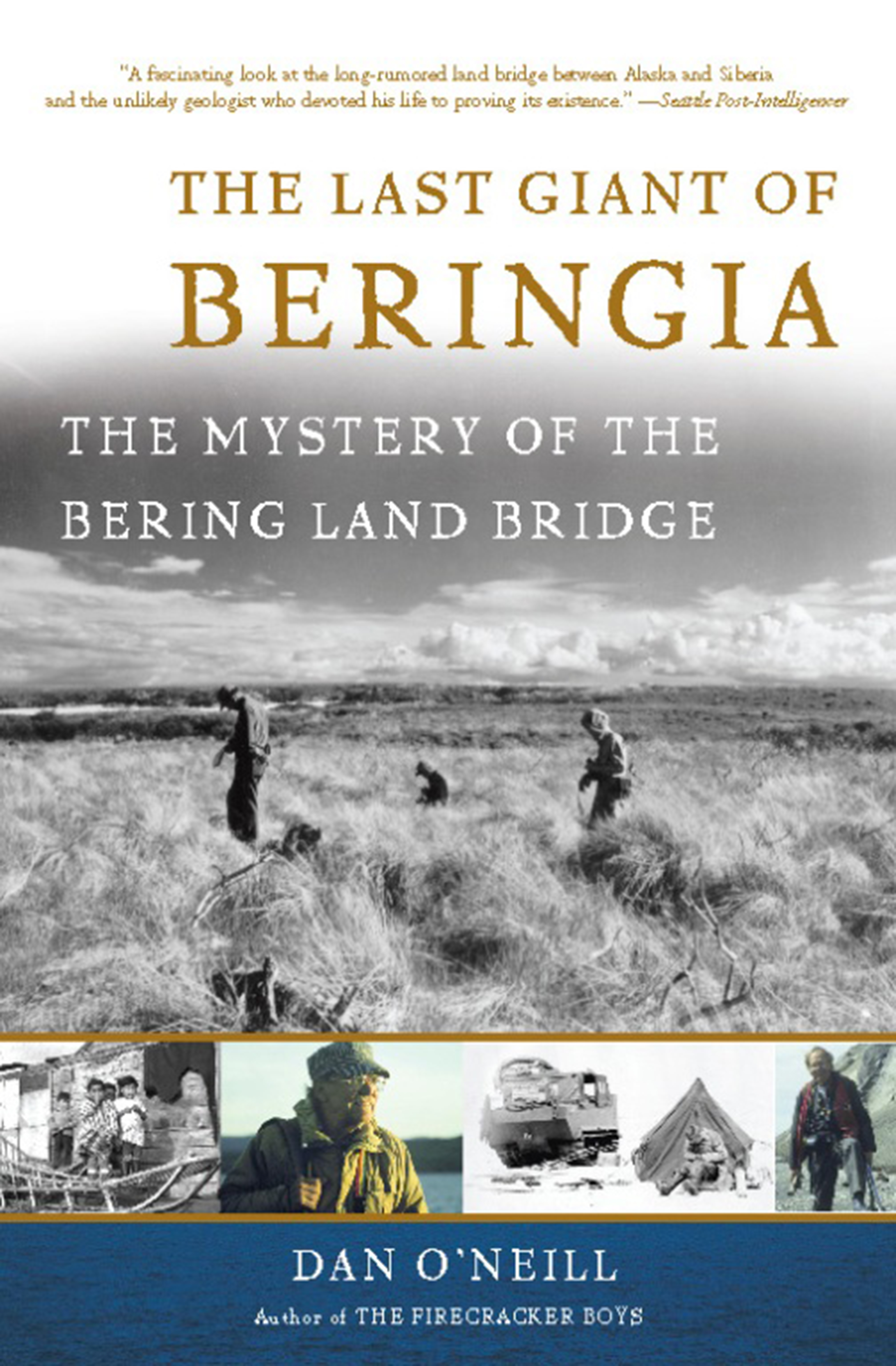
The Last Giant of Beringia
The Mystery of the Bering Land Bridge
Contributors
By Dan O’Neill
Formats and Prices
Price
$8.99Price
$11.99 CADFormat
Format:
- ebook $8.99 $11.99 CAD
- Trade Paperback $19.99 $25.99 CAD
This item is a preorder. Your payment method will be charged immediately, and the product is expected to ship on or around April 29, 2009. This date is subject to change due to shipping delays beyond our control.
Also available from:
Excerpt
Hopkins' 1948 field crew amid grassy hummocks and dead willow near Imuruk Lake, Seward Peninsula, Alaska. Left is probably Bob Sigafoos; the others (with mosquito headnets) are probably Art Fernald and Jim Seitz
(Photo by Dave Hopkins, courtesy of Dana Hopkins)
FOR SARAH
1
THE TOAST OF KHABAROVSK
West to east, from the Ural Mountains on the edge of Europe to the Sea of Japan, the Trans-Siberian Railroad straddles a quarter of the globe. It runs across the Barabiniskaya Steppe and into the taiga, skirting Lake Baikal to the south and Manchuria to the north. One raw spring day during the Cold War, a train carrying scientists clattered east along this great thoroughfare. All across the breadth of the Soviet Union, the train stopped to collect technical specialists, all bound for Khabarovsk on the Amur River, the line's farthest east stop. There it heaved a steamy sigh, and the scientists climbed down to the platform and into waiting taxis. On the road into town, cabs from the station merged with cabs from the airport, all carrying scientists, some from as far away as Western Europe and North America. By nightfall hundreds of scientists from around the world had converged at the old hotel on the town square.
Khabarovsk in 1973 was both rustic town and modern city. Most of the buildings on the square were modern, if blocky and utilitarian. But beyond a radius of a couple blocks, a visitor inclined to stroll found log cabins and outhouses. On warm days when the wind was right, he could detect the latter before descending the hotel steps.
At Khabarovsk, Siberia, in 1973 (right photo), Hopkins stands between his Russian counterpart, Beringian geologist Oleg Petrov, and Rosa Gitterman, a Pleistocene pollen analysis expert. Encouraged by Hopkins since his student days, Russian paleoecologist Andrei Sher (left photo) became Hopkins' collaborator and one of his closest personal friends (Photos courtesy of Andrei Sher)
On this particular evening, the hotel shone with lights as the darkness gathered, and the scientists assembled in the main banquet hall. The dinner party livened as vodka flowed and first one, then another Russian rose to toast political rivals united by science. Everyone got into the spirit. The Hungarians drank to the Czechs; the Czechs saluted the Finns. The East Germans hailed the West Germans, who cheered the Americans, who started the Russians going again. All around the room, bottles clanked noisily on the rims of eight-ounce water glasses, and the revelers tossed off vodka shots chased with champagne. Then one of the Russians started a kind of chant. Others joined in. Quickly it rolled through the room. Feet began to stomp and heavy glasses banged down on the tables. It grew more boisterous and polyglot as every flushed face took it up, a dozen accents calling out HOP-KINS-HOP-KINS-HOP-KINS. And it did not end until a shy, fifty-one-year-old California geologist, wearing longish hair and red pants, pushed his plastic glasses back on his nose and, with reluctance, stood.
Hopkins does not remember the moment, but archeologist Jim Dixon remembers it as if it were yesterday. It would be memorable, says Dixon, if you were a young graduate student, not one of the elite invitees, and had wangled an invitation to the Khabarovsk conference by calling up the renowned Hopkins cold and pleading to be included. "It was impressive. I was very much awed by the greatness of Hopkins, and by the Russians' love for the guy." When the proceedings were compiled into a book, conference chairman V. L. Kontrimavichus introduced it with special reference to Hopkins: "I thank Dr. Hopkins for coming to Khabarovsk for the symposium and for maintaining correspondence later. I thank this great scientist, who is a pioneer and great enthusiast in the study of Bering Land and a great friend of all the Soviet geologists working on Bering Land."
May 1973. Early spring, too, in the incipient thaw in Cold War relations between the Soviet Union and the United States. The two governments were beginning to discover what their Northern scientists had already begun to prove: that they had common ground. Literally. Hopkins called it Beringia.
Beringia (Beh-RIN-gee-a) is the name given to the Bering Land Bridge, the surmised ancient dry land connection between North America and Asia, and to the adjacent then exposed lands, roughly between the Mackenzie River in Canada's Northwest Territories and the Kolyma (or even as far west as the Lena) River in Siberia. But did this hypothetical land bridge really exist? If so, when? What sort of climate prevailed there? Could plants grow so far north during the Ice Age? And could that probably sparse vegetation sustain the gigantic mammals of the Pleistocene—the woolly mammoth and the giant short-faced bear? Finally, can knowledge of this ecological picture, along with archeology, answer a further question—the question—debated for centuries: Did Asian hunters, equipped with skin sewing technology and expertly crafted stone-tipped weapons pursue the drifting aggregations of herbivores north and east across the land bridge and into North America? And were these hunters who passed through Beringia the first to enter not just a new continent, but the back side of the world, an entire hemisphere of the planet never before seen by man?
Though the first Americans' discovery and colonization of half of the earth is one of the great accomplishments in human history, it has been all but overshadowed by disputes as to how they did it and who exactly they were. This debate over the last great migration of the human species, now running for more than four hundred years, has become one of the most rancorous and enduring controversies in all of science.
The story speaks to a more recent and more pressing scientific question as well. The ancient history of this Northern Atlantis (its climate shifts, the record of species exchanges across the land bridge, and the cause of the extinctions of most of the large animals) all may offer clues as to how Northern ecosystems will respond to global climate change in the future. Greenhouse warming attributable to human activities is expected to show its greatest effects in the Arctic. In fact, it seems to be happening now.
D. O'Neil (After Hopkins, 1982)
Fray Jose de Acosta, a Jesuit missionary, first advanced the land bridge theory in 1590. Early Spanish settlers and other European thinkers had difficulty explaining the indigenous people. The Bible had not mentioned them, unless, of course, they were the Lost Tribes of Israel. Perhaps the answer was that they weren't human at all, but had spontaneously generated from mud. That notion had the advantage of making the subsequent enslavement of the natives a less disquieting moral issue. Some speculated that the new land must be Plato's Atlantis and the people Atlanteans. Those who liked to draw on the known to explain the unknown suggested the Indians looked to have the blended blood of Scandinavians, Ethiopians, Chinese, and Indonesians. Others thought, no, the mix seemed more Scythian, with a pinch of Spanish, Welsh, and Polynesian. Even the American Puritan Cotton Mather found the time (after the witch trials reached satisfactory conclusions) to weigh in. In 1702 he wrote, "probably the Devil decoyed these miserable savages hither, in hopes that the gospel of the lord Jesus Christ would never come here to destroy or disturb his absolute empire over them."
But in 1590 Acosta, who had by then been working among the Indians of Mexico and Peru for sixteen years, published a work of natural history that dismissed theories involving Atlantis, Chinese Norsemen, or the animation of mud. As a good friar, he took it as fact that man had not evolved in situ in the New World. Adam and Eve, after all, had been created in the Old World, so man had to have migrated to the new one. Acosta considered transoceanic travel but decided the possibility unlikely. He concluded that the solution to the problem must lie in the as yet unknown northern latitudes. Writing nearly one hundred fifty years before the discovery of the Bering Strait, the wise priest speculated that when explorers ventured into the upper reaches of North America, they would find that the Old and New Worlds were either "continued and joined with the other," as the two American continents were, or that "they approach on neerer unto another" across a narrow water gap that would not greatly inhibit migration.
When he addressed the issue of animal migration, particularly of the smaller beasts, Acosta thought overland travel a more likely explanation than their having swum even a short stretch of ocean. He further theorized that the human occupation of the Americas was less a migration, per se, than a gradual expansion accomplished "without consideration in changing by little and little their lands and habitations. Some peopling the lands they found, and other seeking for newe, in time they came to inhabit the Indies." Similarities between the indigenous people of the Americas and Asian peoples seemed obvious, and the notion of a land connection was generally accepted thereafter.
Until 1728. On a foggy day in that year, Vitus Bering sailed through the strait later named for him, proving that no landmass connected North America to Asia. Had the day been clear, Bering and his men would have beheld one continent to starboard and another to port. And had he tossed a sounding line overboard, it would have told the rest of the story.
Like lines of longitude gathering at the North Pole, several lines of reasoning converged on the hypothesis of a northern migration route to the New World. In 1778, Captain James Cook sailed through Bering Strait, noting that only a short reach of sea separated the continents, and convincing many that this was the point of entry for the first Americans. In 1887, a geologist named Angelo Heilprin noticed that a comparison of Old and New World animal species showed they were quite dissimilar in southern latitudes, more alike in midlatitudes, and nearly identical in the north. This strongly suggested that, if species diversification was a function of distance from the north, then the species must have dispersed from that direction. A few years later another geologist, George Dawson, observed that the seas separating Alaska and Siberia are shallow and "must be considered physiographically as belonging to the continental plateau region as distinct from that of the ocean basins proper." Dawson suggested that "more than once and perhaps during prolonged periods [there existed] a wide terrestrial plain connecting North America and Asia." His idea was that earth movements or continental uplift had periodically established or submerged the connection.
Then, in 1892, mammoth bones showed up on the Pribilof Islands, three hundred miles from the Alaska mainland. Either these giant hairy elephants were awfully good swimmers, or the islands were once high spots in a broad plain, conjunct south to north with the entire Alaskan and Siberian landmasses. A Canadian geologist named W. A. Johnson added the final theoretical puzzle piece. In 1934, Johnson made the connection between fluctuations in sea levels and past periods of glaciation. "During the Wisconsin stage of glaciation," he wrote, "the general level of the sea must have been lower owing to the accumulation of ice on the land. The amount of lowering is generally accepted to be at least 180 feet, so that a land bridge probably existed during the height of the last glaciation ... ." At about the same time, Eric Hultén described his theories of a vast, largely unglaciated lowland that served as a refuge for plants and animals during the Ice Age. Naming the land Beringia, Hultén supposed it had been the terrestrial route taken by humans into the New World. That was the state of scientific understanding in the late 1940s when Hopkins turned his attention to the problem.
At Khabarovsk in 1973, Hopkins was only halfway through a fifty-year study of the Bering Land Bridge. Nonetheless, he was already the world's leading authority. For half a century, scientists from a range of disciplines would orbit Hopkins and the core of scientific understanding that he amassed. Like comets hurtling into dark regions of space, they would inevitably loop back to him, drawn by his gravity, glowing with the results of their voyage. And, reenergized by proximity to him, they would blaze outward again into as yet unlit regions of the past.
2
THE ICE AGE
The Pleistocene Epoch, commonly called the Ice Age, began about 1.75 million years ago. It ended just ten thousand years ago, though some scientists think we are still in it, merely enjoying an "interglacial" reprieve—a day at the beach in geologic time. During this period, the climate was not uniformly cold, but fluctuated in great cycles. Warming trends followed cooling ones, sometimes oscillating in periods of tens to hundreds of thousands of years. In the most recent of these cold cycles, temperatures fell starting about twenty-eight thousand 1 years ago and continued falling until perhaps eighteen thousand years ago. Brutally cold conditions, unlike anything known on the planet today, locked down on the polar regions and the adjacent latitudes. The effect was greater in the Northern Hemisphere owing to peculiarities of weather patterns and ocean currents, which owed in turn to the direction of the earth's rotation, differences in the distribution of land and sea, and irregularities in the earth's orbit. In colder regions, more snow fell in the winter than melted in the summer. So, it accumulated. It built up in layers that melted slightly, condensed and recrystallized. Each new season's snowfall compressed the layers beneath it. The result: masses of glacial ice.
Year after year, glaciers thickened until the leading edges pushed out over the land, merging with one another. The Laurentide Ice Sheet, the largest in North America, piled up to a height of nearly two miles. Centered on Hudson Bay, it grew to cover practically all of what is today Canada. It joined with the Greenland Ice Sheet to the east, and plowed its way south nearly as far as what is now the state of Kentucky. At some points, the Laurentide Ice Sheet likely joined North America's other great mass of ice, the three-thousand-mile-long Cordilleran Ice Sheet, which draped itself along the coastal mountains of western North America from Puget Sound to the Aleutian archipelago. Advancing ice also blanketed Northern Europe, scattered parts of Asia, the world's principal mountain ranges, and, of course, Antarctica. Amazingly, glaciers did not penetrate Interior Alaska, where relatively arid conditions inhibited their development.
Where the ice floated on the sea, as pack ice and icebergs, it did not affect sea level. A floating iceberg displaces the same quantity of water that the berg would produce if liquefied. But most of the world's ice was not floating. It sat ensconced on the land and so did affect sea level. Evaporation continued to remove water from the sea, the winds transporting clouds of it over the land, where it fell as precipitation, often snow. Some of this returned to the oceans via the rivers during the cool summer, but much of it remained on the land as ice. Ice sheets held roughly one-twentieth of all the world's water, half of that in the Laurentide Ice Sheet alone. Consequently, the sea fell during the Ice Ages, eventually dropping an estimated one hundred twenty-five meters, or about four hundred feet below its present level.
As the sea receded, the shapes of the continents changed. The eastern seaboard of North America gained real estate as the shoreline migrated hundreds of miles east to the edge of the outer continental shelf. On the Pacific side, the coastline did not change as noticeably because the continental shelf does not extend very far offshore. But north of the North Pacific, in the region of Bering Sea, a shallow continental shelf stretched continuously from Alaska to Siberia. And as the sea pulled away from the shore, Asia and North America began to reach for each other like the outstretched arms of God and Adam on the ceiling of the Sistine Chapel. When the finger tips touched, a charge of new life streamed into the Americas.
D. O'Neill (after Dixon, 1993)
Not all at once, of course. During the most recent glaciation, the first linkup probably occurred with a continuous strip of land running from Siberia's Cape Chaplin, through St. Lawrence Island to the southern part of Norton Sound. But temperatures—and therefore the sea level—continued to fall. The shelf broadened until perhaps eighteen thousand years ago, the height of glacial activity. Then the continental shelf between Alaska and Siberia stood proud of the water for over nine hundred miles, north to south, encompassing the Alaska Peninsula to the south and extending beyond Wrangell Island to the north. North America and Asia were joined at the head like great, sprawling Siamese twins.
For Alaska, the effect was extreme, and it involved much more than a strip of land that permitted overland passage between two continents. With each appearance and disappearance of the Bering Land Bridge, Alaska essentially switched continental allegiances. When it was joined with Asia during the cold cycles, it was perforce cut off from the rest of North America by the very glaciers that had lowered the sea. Then, as a matter of biogeographical reality, Alaska became part of Northeast Asia. During the warm cycles, however, the glaciers melted, causing the seas to rise and the land bridge to flood. With a water barrier in place to the west, and no glacial barrier to the east and south, Alaska again became a province of North America. She was like a fickle lover: when times were warm, she accepted North America's embrace; but when the air grew cold, she reached for Asia.
Traditionally, scientists thought that there were four Ice Ages in the Cenozoic, the current era, extending back about seventy million years. American scientists have named them after states: the Wisconsin, Illinoian, Kansan, and Nebraskan. And between each of these came a warmer, interglacial period they have called, respectively, the Sangamon, Yarmouth, and Aftonian. In Northern Europe, scientists working in the Alps named the four corresponding glaciations there after rivers that flow out of the Alps into the Danube: the Würm, Riss, Mindel, and Gunz. To help keep things crystal clear, researchers from Britain, Northern Germany/Holland, Poland, European Russia, and Siberia have all offered terminology of different partisan provenience. Hence, the last glacial stage is variously known as the Wisconsin, Würm, Monastirian, Devensian, Weichselian, Vistulian, Valdaian, Sarta, and Ermakavo.
By the 1960s, however, drilling records were showing many more glacial tills than just those four. In the 1970s, deep-sea drilling yielded unambiguous evidence for as many as sixteen glacial stages, separated by interglacials, during the last million years or so. The Bering Land Bridge would have connected the continents during each of the glacials, as soon as the sea level fell to about one hundred sixty feet below the present level, while the Bering Strait seaway would have existed during all or most of the interglacials, whenever sea levels rose higher than minus one hundred sixty feet. The exact number of appearances of the land bridge might not be known for a long time.
Of particular interest to Beringian scholars is the last land bridge, which existed at least during the extremely cold period between roughly twenty-five thousand and fourteen thousand years ago (but which may have remained in place more or less continuously through the last interglacial, when sea levels oscillated around the breech point). Great circumpolar plains extended from southern Europe into central Asia, east to Siberia, and across the land bridge into the middle of Alaska. Much of these interior regions, like Interior Alaska, escaped glaciation throughout the Ice Ages because mountains or distances impeded the migration of coastal moisture, inhibiting the snowfall necessary for glaciers to develop. But even if largely free of glaciers, Beringia was still a harsh place, dry and windy. Loess (windblown glacial silt) filled the air and piled up in shifting dunes. The vegetative cover may have been sparse, the land a polar desert, a drier version of today's tundra intermittently established on frozen silt.
Notwithstanding these extremes, Beringia seemed to have supported a great bestiary, more impressive even than its modern African counterparts. Woolly mammoths ranged throughout Beringia, protected from the icy winds by six-inch-thick hairy coats hanging in long skirts. From their domed heads fifteen feet in the air, massive tusks up to thirteen feet long curved and recurved like an art nouveau motif. Ground sloths, torpid behemoths that could attain six thousand pounds, nonetheless displayed wicked claws and teeth. The long-horned and probably fierce steppe bison might have stood as tall at the shoulder as a smallish mammoth. Alongside the forlorn looking faces of muskoxen, broad horns dropped down and terminated in little flips, like the starched caps of Dutchwomen. From a distance, with their humps, rumps, and swaybacks, they looked like double haystacks. On the run, with their guard hair reaching nearly to the ground and all but obscuring their short legs, they seemed to fly over the tundra as if they were riding magic carpets. Horses evolved in North America and crossed the land bridge into Asia (and a good thing they did, because their New World populations were totally extinguished, until European explorers brought their descendants back aboard sailing ships). The saiga antelope, a goatlike antelope with a greatly enlarged muzzle, seemed to be borrowing an evolutionary page from the trunked beasts. Giant stag moose with enormous, long-beamed and many-tined antlers alongside caribou and wild sheep—all these inhabited the land bridge during the Ice Age. Meanwhile, stalking the hoofed creatures on padded feet were the fiercest predators this side of the Jurassic: heavily muscled saber-toothed cats with serrated, six-inch-long canines capable of slicing through the thick neck skin of a large ungulate; lions larger than those in Africa today; packs of timber wolves; and the giant short-faced bear, bigger and more menacing than an Alaskan grizzly.
This sketchy picture represented about all that was known about the Bering Land Bridge and the conditions that created it when an unusual woman took an unusual child for a walk in the woods one spring in rural southern New Hampshire.
3
HEBE'S SON
With a conflicting mixture of pride and Yankee reserve, longtime residents of the Monadnock region of southern New Hampshire refer to Greenfield as one of the "younger" villages thereabouts. After all, they say, it wasn't incorporated until 1791. Any local Indians had vanished into the forest before 1770 when settlers began felling trees, clearing land, and putting up log cabins. Between the rocks and stumps, the settlers planted rye, potatoes, and turnips, later adding corn, pumpkins, and beans. They turned loose their pigs to forage in the woods and shot turkeys and other game birds. By 1795, the townsfolk had erected a handsome meetinghouse, joined in 1885 by a two-story schoolhouse, complete with bell tower. In anticipation of the arrival of the railroad, Charles Hopkins built and ran a general store in 1873, later operated by his sons, Walter and Edwin.
Eventually, Edwin's son Donald and Walter's son Charles took over the store and a grain mill they called Granite State Feeds. Donald had started Bates College in Lewiston, Maine, as a premedical student, but ended it as an animal nutrition specialist. There was an art to mixing chicken and cattle and horse feed, reformulating each feed every week so as to use ingredients whose prices were currently low, and still arriving at the guaranteed nutritional analysis. Donald Hopkins had the gift for it, and even wrote papers on the subject for scientific journals. He could identify the sex of chicks too (a trick even the chicken farmers had trouble with) and diagnose diseases and recommend treatments. Donald was short, but lifting hundred-pound grain sacks had made him strong. He was sociable. He loved to sing and play the piano, even the tough Gershwin pieces. Everyone liked him, especially a co-ed at Bates named Henrietta Moody.
A 1974 view of the general store in Greenfield, New Hampshire, built by Hopkins' great-grandfather in 1873 (Photo by Dave Hopkins, courtesy of Dana Hopkins)
On December 26, 1921, a century and a half after the settlers struck their first ax blow in the forests around Greenfield, the young town's youngest resident was David Moody Hopkins, the newborn son of Donald and Henrietta Hopkins. The family's first home was a spacious apartment above the store built by the boy's great-grandfather. The old building was a handsome three-story affair, counting the mansard roof. The front featured a four-columned, frilly trimmed, covered porch off the first two stories. Along one side ran an attached grain shed with three bays into which horse-drawn wagons could be backed for loading. The store sat proudly at the intersection of Greenfield's five principal roads, in the respectable company of the church, the school, and the library. Along these roads were about sixty wood frame houses. Behind the houses were fields. Behind the fields, woods.
Donald Hopkins, Dave's father, Greenfield, New Hampshire (Photo by Dave Hopkins, courtesy of Dana Hopkins)
Henrietta loved the woods. She had grown up on a farm down east in Turner, Maine, where she was particularly close to a maiden aunt, as she would have been described in those days. Aunt Nell, according to family lore, could name every wildflower found in forest or field in that part of Maine, and during many long walks, she passed on this knowledge to her admiring protégé. Though she never married and had no children, Aunt Nell left spiritual progeny. With those walks, she established a family tradition that has continued now for five generations, about one hundred years.
Genre:
- On Sale
- Apr 29, 2009
- Page Count
- 240 pages
- Publisher
- Basic Books
- ISBN-13
- 9780786738175
Newsletter Signup
By clicking ‘Sign Up,’ I acknowledge that I have read and agree to Hachette Book Group’s Privacy Policy and Terms of Use