Geography and Geology of the Black Hills
The Black Hills of South Dakota are frequently referred to as an “Island in the Plains,” and the description is an apt one. The Cheyenne River sets the southern border while the Belle Fouche River (pronounced Bell Foosh) defines the northern edge. The Thunder Basin National Grassland of Wyoming to the west and the Buffalo Gap National Grassland to the east complete the circle around the hills. The hills rise over 3,000 feet above the plains, reaching their pinnacle of 7,242 feet at Harney Peak, one of the highest points in North America east of the Rocky Mountains.
About two-thirds of the hills are located within the confines of the Black Hills National Forest. The southern region is mixed-grass prairie. The north is lush with ponderosa pine, and even the ridges of the rolling hills of the south sport pine silhouettes. Seen from a distance, the deep green trees appear as a dark band on the horizon, giving the area its name. From east to west, about two-thirds of the hills are located in South Dakota, and one-third spills into Wyoming. Several small rivers cut through the hills, most notably Spearfish Creek in the north, Rapid Creek in the central region, and the Fall River in the south, and bring additional recreational and scenic beauty to the area.

Geology of the Black Hills
The Black Hills were formed by an uplift that occurred near the end of the Cretaceous Period or the beginning of the Paleogene Period, 65-70 million years ago. The uplift created an elliptical dome, at the center of which is a crystalline core, composed of the oldest rocks in the hills. This core is Precambrian, dating back over two billion years. The granite peaks near Mount Rushmore, dominated by the 7,242-foot Harney Peak, are at the center of the uplift. At the time of the uplift, it is estimated that the hills reached an elevation of over 15,000 feet, and the work of wind and water over the last 65 million years has created the hills we see today.
Encircling the Precambrian core of the Black Hills are progressively younger rock layers. Time in the Black Hills looks much like a topographic map, each band a different geological period, marching downward and outward and around the hills, from oldest to youngest through the Precambrian, Paleozoic, Mesozoic, and Cenozoic eras.
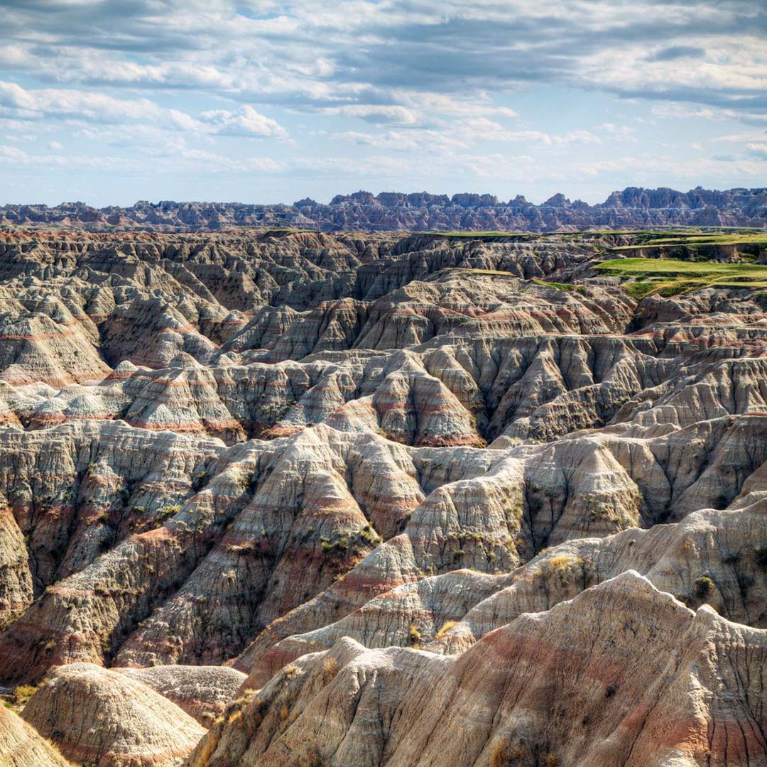
Unlike the Black Hills, in the Badlands, the youngest formations are on the top and time marches straight down. Formed primarily by two geologic processes, deposition and erosion, the oldest exposed (and lowest) layers of the area were created 69-75 million years ago, when the surface area was covered by a warm inland sea. When the hills uplifted, the sea drained away and was replaced by a river floodplain that deposited a new layer every time a flood occurred. A drier period followed, bringing sediments deposited by the wind, the colors varying with time and volcanic activity. As the uplift to the west continued, the water current increased and began to carve into the very deposits earlier streams had left behind. Some 65 million years later, we have the eroded spires and valleys of the Badlands today.


Newsletter Signup
By clicking ‘Sign Up,’ I acknowledge that I have read and agree to Hachette Book Group’s Privacy Policy and Terms of Use
Pin it for Later
